PeakFinder AR | Application Overview
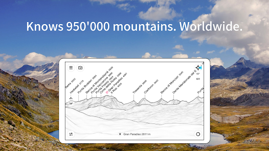
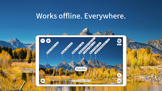
PeakFinder AR provides a 360° panoramic display that identifies over 1,000,000 peaks globally. The application operates entirely offline and utilizes real-time rendering to map landscapes within a 300km (200mi) range.Technical Specifications
| Feature | Details |
|---|---|
| Current Version | 4.8.87 |
| Android Requirement | 7.0+ |
| Database Size | 1,000,000+ peaks |
| Rendering Range | 300km / 200 miles |
| Connectivity | 100% Offline functionality |
| Monetization | One-time purchase; No ads; No recurring costs |
Core Functional Features
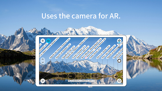
- Augmented Reality (AR): Overlays mountain silhouettes and names directly onto the live camera feed (requires gyroscope and compass).
- Visual Tools: Includes a digital telescope for identifying less prominent peaks and a "Show me" function for visible landmarks.
- Navigation & Viewpoint: Viewpoint selection via GPS, peak directory, or integrated map. Includes a "Bird's Eye" flight mode for aerial perspective.
- Celestial Tracking: Displays solar and lunar orbits, including rise and set times.
- Data Updates: Daily synchronization of the peak directory.
Version 4.8.87 Changelog
- Photo Editor Update: Introduced fine adjustment tools for aligning mountain silhouette overlays within the photo editor.
Modification (Mod) Details
| Component | Status |
|---|---|
| License | ρáíd / Patched / Premium |
| Permissions | Unwanted Permissions, Receivers, Providers, and Services removed |
| Optimization | Debug code removed; Analytics, Crashlytics, and Firebase disabled |
| Feature Access | Digital telescope and all premium tools unlocked |
You do not have permission to view the full content of this post. Log in or register now.