 PH
PH
File size: 38.5 MB
MapRelate is a GIS data importer for Autodesk® AutoCAD®. Geospatial data is essential background or engineering base data, but is typically managed by GIS systems and therefore held in proprietary formats including ESRI SHP, MapInfo, and Oracle.
MapRelate provides the facility, directly from within AutoCAD, to translate this data into entities in your drawing, allowing them to be edited and saved into the DWG file. MapRelate works on a concept of datasource configuration to give maximum flexibility in determining how GIS data is read and interpreted with options for text, blocks, polylines and polygons with a layer, linetype and color overrides. Drawing data can be drawn from the whole datasource or, for large datasets, filtered by the current CAD view to ensuring that you are only getting the GIS information you need.
Autodesk AutoCAD
Version: 2025 , 2024 , 2023 , 2022
Autodesk AutoCAD Architecture
Version: 2025 , 2024 , 2023 , 2022
Autodesk® Civil 3D®
Version: 2025 , 2024 , 2023 , 2022
Autodesk AutoCAD Map 3D
Version: 2025 , 2024 , 2023 , 2022
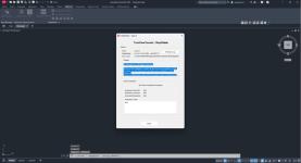
Screen :
What's New
Spoiler contents are visible only to Established Members.
HOMEPAGE
Code:
https://apps.autodesk.com/
You do not have permission to view the full content of this post. Log in or register now.
You do not have permission to view the full content of this post. Log in or register now.
You do not have permission to view the full content of this post. Log in or register now.