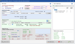
Description PVsyst is designed to be used by architects, engineer, and researchers. It is also a very useful educative tool. It includes a detailed contextual Help menu that explains the procedures and models that are used, and offers a user-freindly approach with guide to develop a project. PVsyst is able to import meteo data from many different sources, as well as personal data. Direct search for a location using Google Maps Full Meteonorm interpolation program for any location on earth Defines the position of all modules of the system in the 3D field Computes the electrical circuit at the input of each inverter Outputs: "Irradiance shading loss" and "electrical shading loss" Direct shading calculation during the simulation (avoids interpolation uncertainties) Big plants: optimized calculation of the shading factor Plants following the terrain (Helios 3D): orientation analysis and management Improved project management: parameter access, copy, templates Details
File Size: 812 MB
Download LinksYou do not have permission to view the full content of this post.Log in or register now.You do not have permission to view the full content of this post.Log in or register now.
discuss3387Need to generate premium links such as Rapidgator and Nitroflare? >> Request Here! COLOR]
 PH
PH