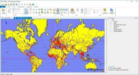
Description OkMap is an interactive software which allows you to work on your computer screen with web maps or digital maps that you have either bought or scanned. OkMap can also import vectorial data from the most common formats and DEM data relevant to height information. Through these maps, you can organize your paths by creating waypoints, routes and tracks on your computer monitor, and upload this data to your GPS. OkMap sets automatically altitude data and estimates travel times. - Calibration / display raster maps (over 30 image formats) - Display hybrid maps (raster + vectorial data) - Ability to open multiple maps simultaneously - 9 cartographic projections of the most used - Database with over 500 predefined projections by geographic area - Viewing 3D raster maps on Google Earth (for supported image formats) - Map add-ons management (icons, comments) - Vectorial data management (point, multipoint, line, polygon) - GPX data management (waypoints, tracks, routes) Details
File Size: 189.64 MB
Download LinksYou do not have permission to view the full content of this post.Log in or register now.
discuss3387Need to generate premium links such as Rapidgator and Nitroflare? >> Request Here! COLOR]
 PH
PH